Total ILA Acres: 154
Total Lake surface Acres: 123
Total shoreline miles: 5.83
Number of Homes on Lake Vilbig: 234
Approximate Number of Lake Vilbig Residents: 538.2 (2.3 x 234)
Location: South Irving, Texas (Near MacArthur & Hunter Ferrell).
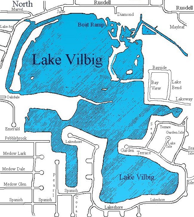
Streets That Border the Lake: Lakeshore Dr., Spanish Tr., Pearl Ln.,
Pebblebrook Tr, Lakeway,
Emerald Rd., Oakdale Rd., Rusdell, Diamond,
Sea Terrace, Garden Terrace.
Water source: Freshwater springs and local storm drains
Maximum water depth: 30 ft
Other Maps
The next 3 maps were created in 2009 during a drought and due to the drought, some areas did not get fully mapped. The maps are close on the depth but do not show the deepest hole which is 30-ft. The maps did consider the drought when marking the water depth. They are very big PDFs and will take longer to load, be patient. The wall size is huge. It's perfect for printing and will look good in your home or office.
Lake Vilbig Map - Contours
Lake Vilbig Map - Shaded lake depth
Lake Vilbig Map - Wall size with contours and shaded depths
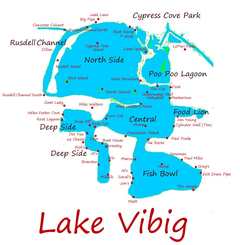
The next map is to aid fishermen. It contains reference points to describe the different locations on the lake.
Lake Vilbig Map - Fisherman's reference points
The next map is a structure map. The depths are short because some of the contour lines are missing to allow for other marker indicators. This is big so it may take some time to load.
Lake Vilbig Map - Structure
More Maps
Lake Vilbig Map - House lots
Lake Vilbig Map - Highways
Lake Vilbig Map - Plain blue/green
Lake Vilbig Map - Plain blue/white
Lake Vilbnig Map - Shoreline Miles Map
Home|Web Author
Total Lake surface Acres: 123
Total shoreline miles: 5.83
Number of Homes on Lake Vilbig: 234
Approximate Number of Lake Vilbig Residents: 538.2 (2.3 x 234)
Location: South Irving, Texas (Near MacArthur & Hunter Ferrell).
Water source: Freshwater springs and local storm drains
Streets That Border the Lake: Lakeshore Dr., Spanish Tr., Pearl Ln.,
Pebblebrook Tr, Lakeway,
Emerald Rd., Oakdale Rd., Rusdell, Diamond,
Sea Terrace, Garden Terrace.
Maximum water depth: 30 ft
Other Maps
The next 3 maps were created in 2009 during a drought and due to the drought, some areas did not get fully mapped. The maps are close on the depth but do not show the deepest hole which is 30-ft. The maps did consider the drought when marking the water depth. They are very big PDFs and will take longer to load, be patient. The wall size is huge. It's perfect for printing and will look good in your home or office.
Lake Vilbig Map - Contours
Lake Vilbig Map - Shaded lake depth
Lake Vilbig Map - Wall size with contours and shaded depths
The next map is to aid fishermen. It contains reference points to describe the different locations on the lake.
Lake Vilbig Map - Fisherman's reference points
The next map is a structure map. The depths are short because some of the contour lines are missing to allow for other marker indicators. This is big so it may take some time to load.
Lake Vilbig Map - Structure
More Maps
Lake Vilbig Map - House lots
Lake Vilbig Map - Highways
Lake Vilbig Map - Plain blue/green
Lake Vilbig Map - Plain blue/white
Lake Vilbnig Map - Shoreline Miles Map
Home|Web Author